Authors: Dr Matthew Sorell, Dr Bailey Heading, Charlotte Sorell
DFRWS APAC 2026
Abstract
Geolocation artefacts are often referred to as “GPS” as shorthand, but this often a misleading description. Modern phones use hybrid techniques for location, incorporating WIFI and cellular beacons as well as inertial reckoning. Recent updates to GPS, with dual band L1 and L5 receivers, eliminate the need for an assumed ionospheric model and come with unprecedented precision. And then there are the intricacies and limitations of the WGS84 datum, and the challenges of continental drift. Finally, there are implementation shortcuts, biases and limitations to consider In this workshop, we’ll apply an academic approach to the practical challenges of understanding, interpreting, and setting out the limitations of geolocation data when applied to criminal investigation and evidence in Court. With a little bit of physics and radio engineering thrown in, our goal is to move beyond the naïve “GPS Fix” label applied to location data.
Learning Objectives
At the end of this workshop, participants will be able to:
- Describe the principles of GPS and hybrid geolocation technologies currently used in mobile phones
- Identify and describe key recent updates to GPS and their impacts, most notably dual band (L1 and L5) implementation
- Identify and describe key sources of geolocation records in the Apple iOS environment, their limitations and updates since iOS12.
- Correctly interpret geolocation records including spatial coordinates, velocity, and accuracy
Target experience level
This workshop is intended for beginner to mid-experience examiners and analysts working with mobile phone extractions. Some familiarity with phone analysis tools (which might include iLEAPP and commercial tools) is helpful but not required, as the workshop will critically examine what is present and what is missing in typical tool reports.
Workshop description
The course will cover the following topics:
- Principals of GPS technology, including limitations and technology updates
- Principals of hybrid geolocation technologies, including limitations
- A tour of geolocation data in the Apple iOS ecosystem
- Understanding coordinates, geodetic datums and how mapping tools work
- Route planning and mapping
Preparation details
Course datasets:
- iPhone5s-iOS12-4-6.zip – Dropbox
- iPhoneSE2020-iOS16-4-1.zip – Dropbox
You can download the datasets using the Dropbox links here or directly from the DFRWS server in the Downloads section below.
Participants should have the following tools installed and available:
- DB Browser for SQLite (https://sqlitebrowser.org/)
- iLeapp (https://github.com/abrignoni/ILEAPP)
An Internet connection may be required to access mapping tools
Biography
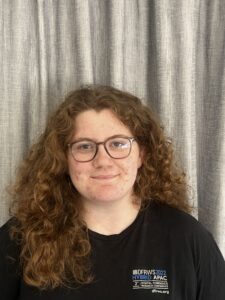
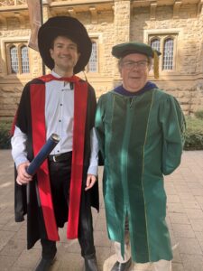
| Dr Matthew Sorell is visiting professor of Digital Forensic Science at the Tallinn University of Technology (Estonia) and Aalto University (Finland) and a veteran academic in telecommunications engineering at Adelaide University. He is an experienced subject matter expert in mobile phone forensics across over 500 cases including the high profile Death Cap Mushroom murders in Australia, having served as scientific advisor to the EU FORMOBILE project. He is principal of Quintilian Digital Pty Ltd. |
| Dr Bailey Heading is a recent PhD graduate specialising in radio signal modelling in complex 3D environments, with a background in geospatial intelligence. He is the geospatial specialist at Quintilian Digital Pty Ltd and a recognised subject matter expert in telecommunications systems in South Australia. |
| Charlotte Sorell is an Honours student in Electrical and Electronic Engineering and Applied Physics at Adelaide University, specialising in geospatial systems. She is a geospatial researcher at Quintilian Digital Pty Ltd. Charlotte is also an experienced tutor and qualified trainer in anglo-campanology, and brings that presentation experience to the classroom. |
Downloads
| iPhone5s-iOS12-4-6.zip (Other) |
| iPhoneSE2020-iOS16-4-1.zip (Other) |